Loading
Globe
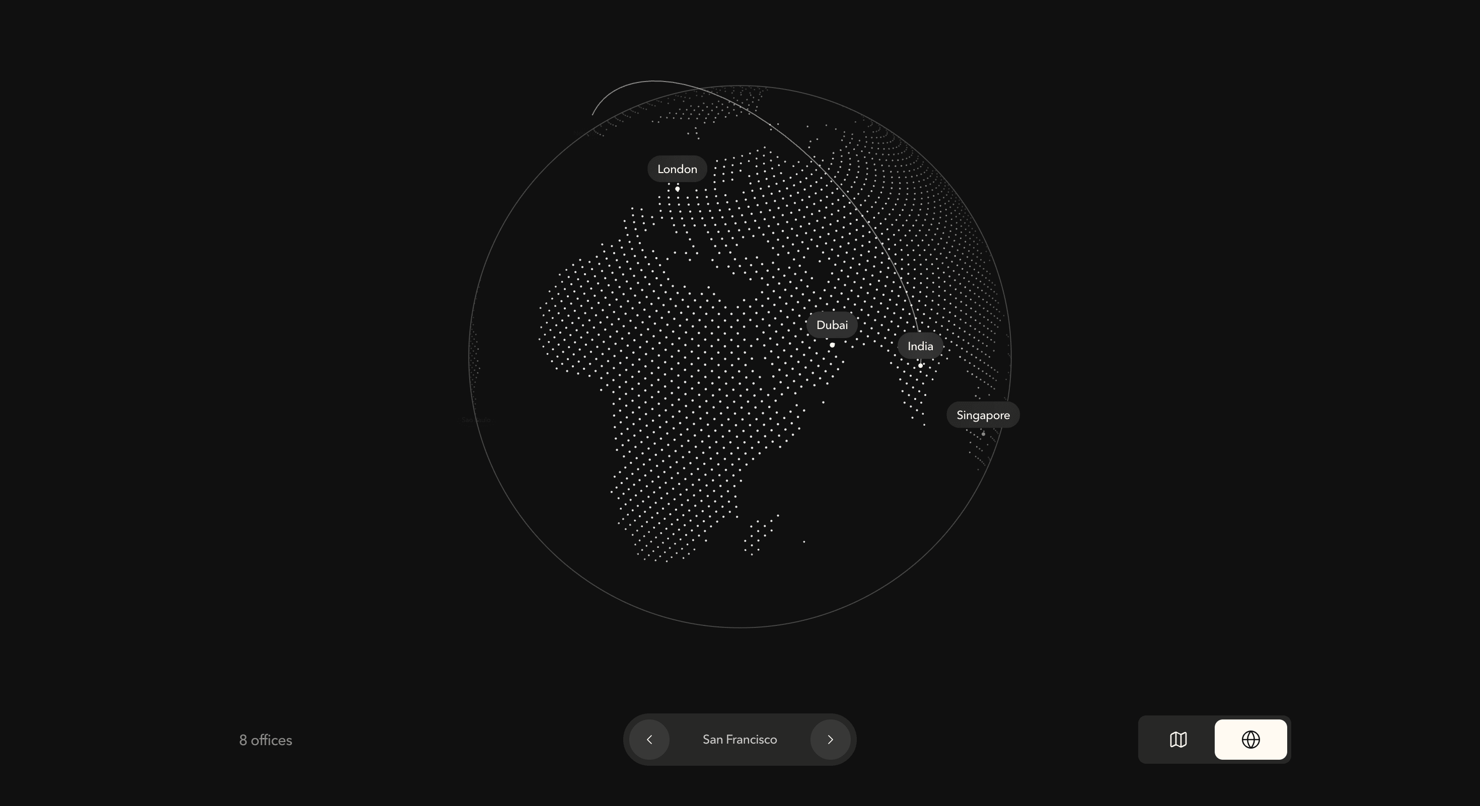
An interactive map-and-globe component for SaaS, fintech, logistics, travel, infrastructure, AI, cybersecurity, and global product pages where location data should feel spatial, connected, and alive.
Published On: September 17, 2026
Last Updated: September 17, 2026
lucide-reactGSAP
Overview
Globe gives global information a stronger visual system than a plain list of cities.
Locations can appear as labelled points across a world map or dimensional globe. Selected regions, city markers, connection lines, route paths, and view controls help visitors understand where a product operates, where teams are located, where infrastructure runs, or how global activity moves across the system.
Use Globe when geography is part of the story. It works for companies showing market coverage, data centers, customer regions, logistics routes, travel networks, expansion plans, founder presence, community distribution, event locations, or global product adoption.
The page job is orientation. The visitor should understand the global footprint quickly, then inspect specific locations without losing context. The globe should make the company feel connected, not turn the page into a dark planet simulator with marketing labels orbiting in confusion.
Install Command
This is a Pro Effect.
You can preview it now. Upgrade to Pro for instant install access.
Usage Code
This is a Pro Effect.
You can preview it now. Upgrade to Pro for instant install access.
Component Code
This is a Pro Effect.
You can preview it now. Upgrade to Pro for instant install access.
Example Production Use Case
A fintech infrastructure company can use Globe to show supported markets, partner regions, and transaction corridors. Visitors can see where the product operates, which regions are active, and how the network connects without reading a long geography paragraph.
The outcome is credibility through orientation. The page communicates scale, reach, and movement in one visual system.
A SaaS company can use the same component to show customer distribution, team locations, data center coverage, or launch regions. The globe gives abstract growth a concrete surface, which helps the visitor understand scope faster.
Best Used For
• Global SaaS, fintech, infrastructure, logistics, travel, and cybersecurity products.
• Office, team, customer, or partner location sections.
• Route maps, network diagrams, data-flow visuals, and regional coverage pages.
• Launch pages showing market expansion or international availability.
• Investor, enterprise, or trust pages where operational reach matters.
• Community and event pages where geographic spread is part of the proof.
Not For
Not for pages where geography is not meaningful.
Not for fake global presence. If the business only operates in one region, use a local map, market section, or customer story instead of pretending the world needs to rotate.
Not for dense operational dashboards, legal coverage lists, compliance matrices, or anything users need to scan with precision. Use tables when exact regional rules matter.
Performance Budget
Keep location count controlled, optimise route rendering, and avoid excessive label animation. If the component uses Canvas or WebGL, cap device pixel ratio, clean up animation loops, and pause motion when the component is outside the viewport.
Do not animate every marker, label, line, and globe rotation at full intensity at the same time. Global reach should feel impressive without making the browser feel like it has been asked to run air traffic control.
Accessibility and Mobile
Provide a readable text alternative for meaningful location data. A visual globe should not be the only way to access supported cities, regions, offices, or routes.
Use accessible controls for view toggles, selected locations, and route interactions. Preserve keyboard access where the component is interactive. On mobile, simplify the layout, reduce label density, shorten animations, and consider a flat map or stacked location list when the globe becomes too cramped.
For reduced motion, pause continuous rotation, remove route drawing, disable camera travel, and show a stable map or static globe state with readable location information.
Common Mistakes
• Showing too many labels at once.
• Using route lines with no real meaning.
• Making the globe decorative while hiding important location information.
• Forgetting a mobile-friendly fallback.
• Running continuous animation when the section is offscreen.
• Using vague labels like “Global” without specific locations.
• Making map controls look polished but unclear.
• Treating geography as proof when the data does not support it.
Changelog
v1.0.0
Sep 17, 2026Initial release
Props
| Prop | Type | Default | Description |
|---|---|---|---|
autoConnect | boolean | false | Periodically animates a route between two random locations. |
autoRotate | boolean | true | Continuously rotates the globe when it is idle. |
rotationSpeed | number | 4 | Automatic globe rotation speed in degrees per second. |
routeFrequency | number | 3.5 | Delay in seconds between automatic route animations. |
routeDuration | number | 1.4 | Duration of each animated route in seconds. |
connections | number | 3 | Number of nearby routes emitted after selecting a location. |
dotDensity | number | 11000 | Number of sphere samples used to build the dotted land field. |
dotSize | number | 2.3 | Rendered diameter of each land dot in pixels. |
markerSize | number | 5 | Rendered diameter of each location marker in pixels. |
routeColor | color | #fffaf2 | Color of animated connection routes. |
mapColor | color | #ffffff | Color of the dotted land field. |
markerColor | color | #fffaf2 | Color of location markers and the globe outline. |
showLabels | boolean | true | Shows location labels around the globe. |
enableDrag | boolean | true | Allows pointer dragging to rotate the globe. |
morphDuration | number | 0.6 | Duration of the globe-to-map projection transition in seconds. |
Frequently Asked Questions
What is Globe?
Globe is a React component for presenting locations, routes, global coverage, or regional presence through a map, 3D globe, or switchable geographic interface.
When should I use Globe?
Use it when geography matters to the page: supported markets, customer regions, data centers, office locations, logistics routes, event cities, partner networks, or global community distribution.
Is Globe only decorative?
It should not be. Globe works best when the locations and routes communicate real product, market, infrastructure, or brand information.
Can Globe support a flat map and a 3D globe?
Yes, depending on the implementation. A flat map is often clearer for scanning, while a globe adds spatial atmosphere and global presence.
What should reduced motion do?
Reduced motion should stop continuous rotation, route drawing, camera movement, and animated marker travel. Show a static map, stable globe, or readable location list.
Request a Custom Component Animation
Need a custom effect? Tell us what to create.


